Front
Posted:
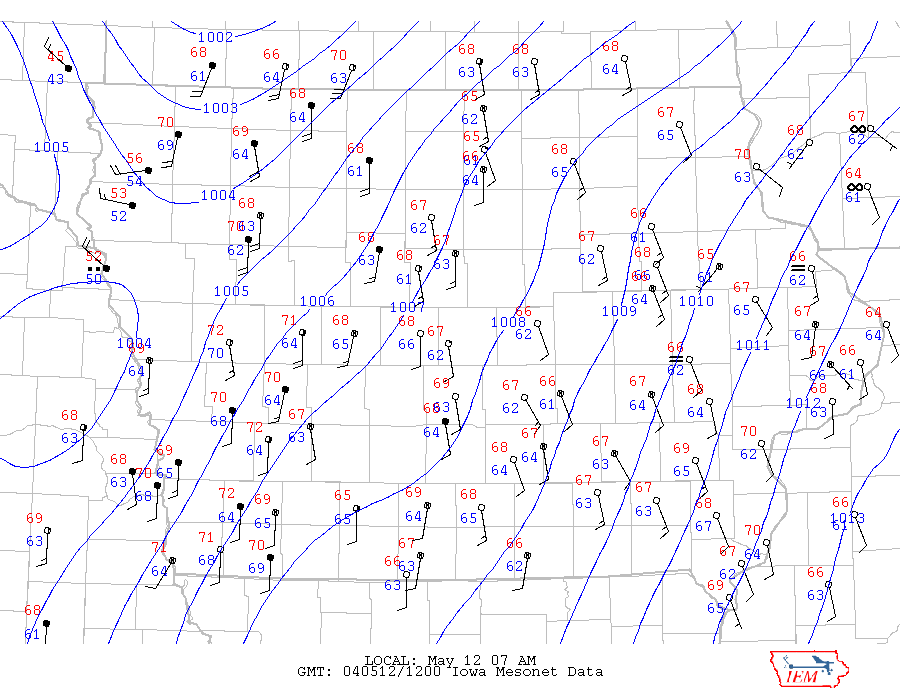
A strong surface cold front has made its way into NW Iowa this morning. The featured mesonet plot really shows the change in wind direction and air temperature associated with this feature. Some strong storms are expected to develop along this boundary later today.